Club Meeting, 20 April ’26; Speaker & Topic: “Sally Johnsen, From Foraminifer to Fusinus; some marine fossils of Roe Plain, Western Australia”
DATE & TIME
- 20 April 2026
- 7.30pm Arrival
- This event commences in:
Meeting Speaker: Sally Johnsen
LOCATION
- Toowong Uniting Church Hall, 82 Sherwood Road, Toowong
Introduction
This presentation will give an overview of the geological formation of the Roe Plains, outline their current structure and features, and introduce the audience to some marine fossils found therein, including extant and extinct species.
Location & Geology
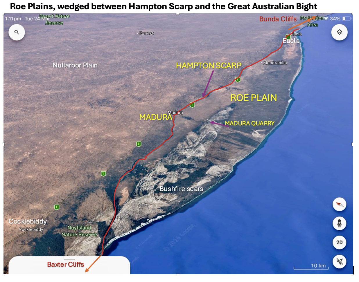
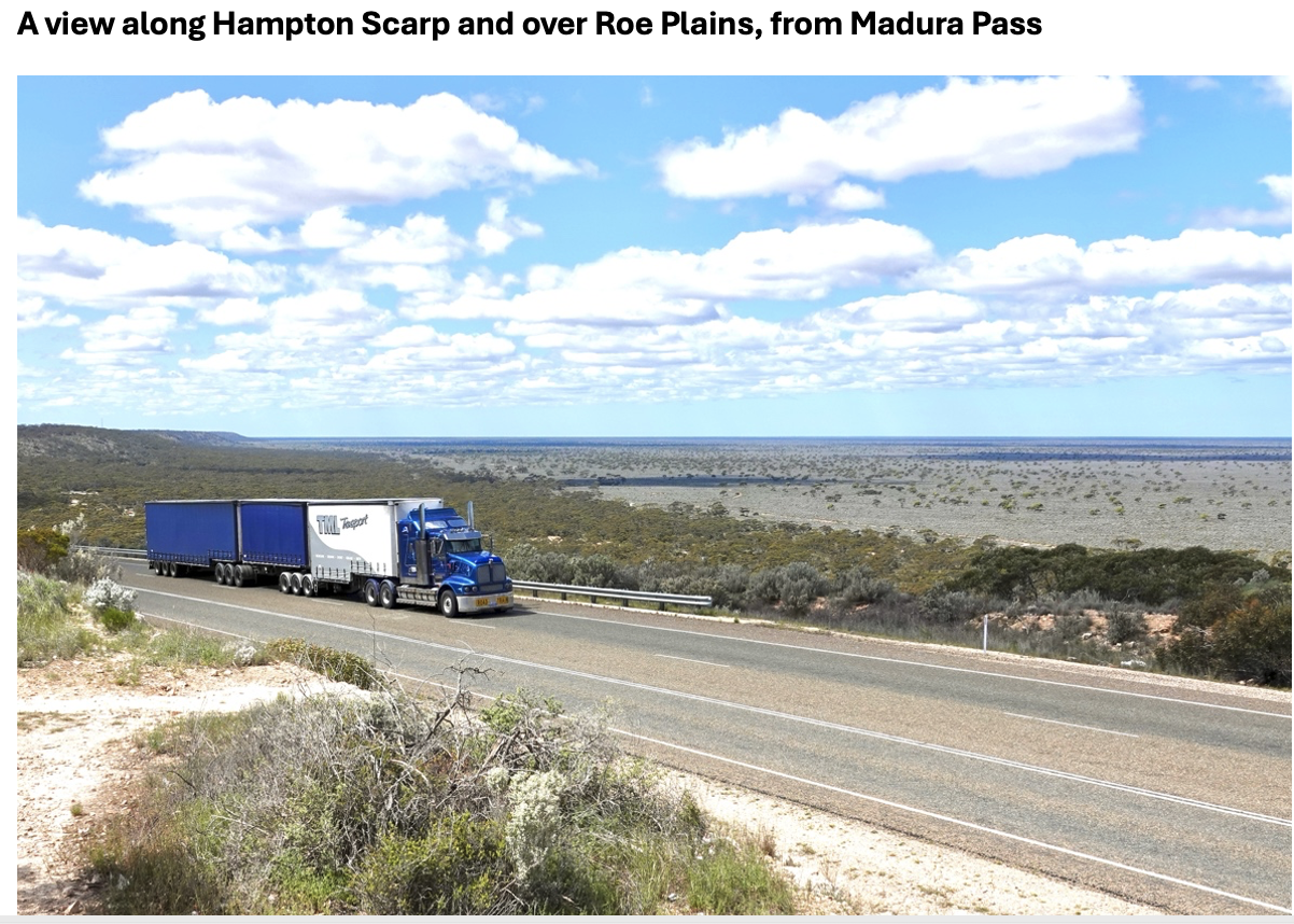
The Baxter Cliffs north of Eucla and the Baxter Cliffs south of Cocklebiddy are shear cliffs meeting the ocean. However, between Cocklebiddy & Eucla the escarpment tracks inland, with a coastal plains on the escarpments south.
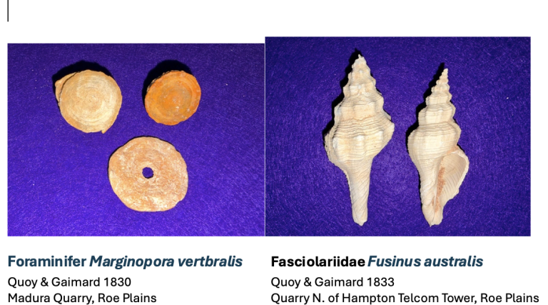
The Roe Plain, located south of the Nullarbor Plain and beneath the Hampton Scarp, is approximately 300 km in length and 20 m above the current sea level. Roe Calcarenite, a marine fossil-rich band approximately 2-3 metres thick, extends across the plain and is dated to the late Pliocene era (2.6 million years ago).
Excavation and quarries for construction of the Eyre Highway and other roads, as well as openings into limestone caves on the Roe Plains, have exposed more than 265 marine species and subspecies of intertidal, littoral and sublittoral origin. These marine species accumulated after death near the margin of a shallow sandy indentation of the coastline, which, through geological activity, was uplifted to form the Roe Plain.